
Your Quick Guide to Navigating Palm Beach with Google Maps
Google Maps Palm Beach makes it easy to explore one of Florida’s most iconic barrier island towns — whether you’re planning a trip or already there.
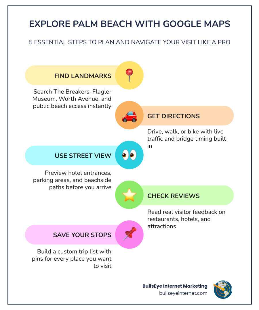
Here’s what you can do with Google Maps in Palm Beach right now:
- Find landmarks — Search The Breakers, Flagler Museum, Worth Avenue, and public beach access points instantly
- Get directions — Drive, walk, or bike with live traffic and bridge timing built in
- Use Street View — Preview hotel entrances, parking areas, and beachside paths before you arrive
- Check reviews — Read real visitor feedback on restaurants, hotels, and attractions
- Save your stops — Build a custom trip list with pins for every place you want to visit
Palm Beach sits on a narrow barrier island in Palm Beach County, Florida. It was incorporated on April 17, 1911, and has grown into one of the most recognizable luxury destinations in the United States. With a year-round population of just 10,468 — but an estimated 30,000 residents during peak season — the town swells with visitors every winter. That seasonal surge makes smart navigation essential.
Knowing how to use Google Maps here isn’t just convenient. It can be the difference between a smooth trip and a frustrating one.
I’m Ronnie Katz, founder of BullsEye Internet Marketing, and I’ve spent over 20 years helping businesses across South Florida — including Palm Beach County — grow their visibility on Google Maps Palm Beach and beyond. Whether you’re a visitor trying to find parking on Worth Avenue or a local business owner wanting to show up in more searches, this guide covers what you need to know.
Easy Google Maps Palm Beach glossary:
Google Maps Palm Beach: What It Shows and Why It Matters
When you pull up Palm Beach – Google Maps, you aren’t just looking at a digital grid; you’re looking at over a century of documented development. As of May 2026, the platform provides an incredibly detailed view of this 16-mile-long barrier island, separated from the mainland by the Intracoastal Waterway.
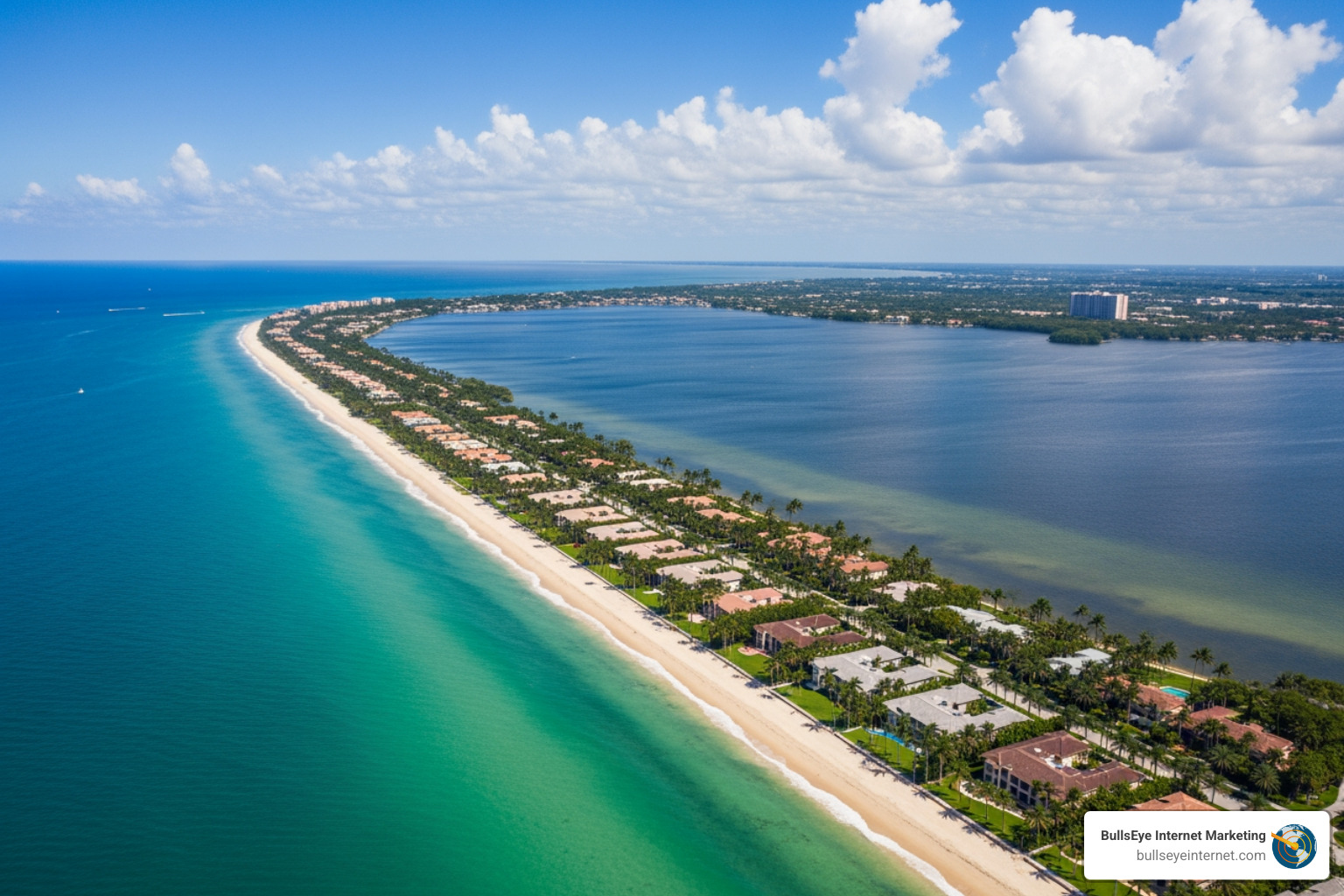
The town’s geography is unique. Located at Latitude 26.705593 North and Longitude 80.037727 West, it occupies the 33480 ZIP code. Because the island is so narrow, Google’s high-resolution satellite imagery is particularly helpful for seeing how the Atlantic Ocean on the east and the Lake Worth Lagoon on the west dictate the town’s layout.
The history behind Palm Beach’s map
The town was incorporated in 1911, but its “map” was truly put on the world stage by industrialist Henry Morrison Flagler. Through the Florida East Coast Railway, Flagler transformed this wild stretch of land into a playground for the elite.
Using historical documentation and modern mapping, we can see how Flagler’s influence remains. Key sites like the Royal Poinciana Hotel (once the largest wooden structure in the world), the iconic Breakers Hotel, and Flagler’s own Whitehall mansion (now the Flagler Museum) serve as the anchors for the town’s modern digital map. These landmarks aren’t just points of interest; they are the historical pillars that define the town’s North, Mid, and South sections.
How Google Maps Palm Beach reflects the town today
Today, Google Maps Palm Beach reflects a town that balances strict residential preservation with world-class luxury commerce. The map clearly defines the town boundaries, showing where the manicured hedges of the estate sections end and the vibrant shopping district of Worth Avenue begins.
You can use the Official Map of Palm Beach, Florida via Google Maps to see the various public beach access points—which are often tucked between private estates—and the famous Lake Trail, a paved path perfect for cyclists and walkers that hugs the Intracoastal side of the island.
How to Explore Palm Beach Neighborhoods, Streets, and Landmarks
Palm Beach is often divided into distinct areas: the North End, Midtown, and the South End. Each has a different “vibe” on the map. The North End is largely residential and quiet, while Midtown contains the bulk of the town’s commercial and historical activity.
Key landmarks to search in Google Maps Palm Beach
When you use Palm Beach, Florida – Google Search to find things to do, several “must-pin” locations will appear:
- The Breakers: This sprawling oceanfront resort is a city within a city.
- Whitehall (Flagler Museum): A historic Gilded Age mansion.
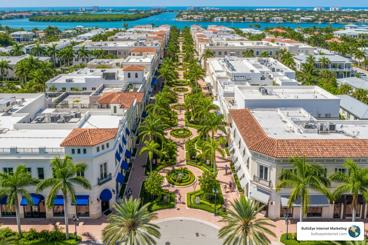
- Worth Avenue: Often called the “Rodeo Drive of the East Coast,” this area is a maze of “vias” (beautifully landscaped courtyards) that are best explored using Street View.
- The Lake Trail: A 5.5-mile scenic trail that offers views of the West Palm Beach skyline and some of the island’s most impressive backyards.
Nearby places visitors often confuse with Palm Beach
One of the biggest mistakes visitors make is confusing the Town of Palm Beach with its neighbors.
- West Palm Beach: Located directly across the bridges on the mainland. It is a much larger city with a different government and vibe. Check West Palm Beach – Google Maps to see the difference.
- Royal Palm Beach: This is a completely separate village located much further inland.
- Delray Beach: A vibrant coastal city about 20 miles south. You can find it here: Delray Beach – Google Maps.
Understanding these distinctions on Google Maps Palm Beach prevents you from booking a hotel in the “wrong” Palm Beach!
Best Google Maps Features for Visiting Palm Beach
To get the most out of your visit in May 2026, you should look beyond the basic blue dot.
Use Street View before you arrive
Street View is a lifesaver for navigating the narrow, one-way streets of Midtown Palm Beach. You can Explore Palm Beach via Google Street View to see exactly where a restaurant’s valet stand is located or to find the specific gate for a beach access path. Since street parking is notoriously limited and strictly enforced, “pre-walking” the block digitally can save you a parking ticket.
Use satellite view to understand the island layout
The Satellite View of Palm Beach Island – Google Maps is the best way to visualize the three bridges (Royal Park, Flagler Memorial, and Southern Boulevard) that connect the island to the mainland. It also helps you spot the difference between the “Ocean side” (Atlantic) and the “Lake side” (Intracoastal), which is crucial for planning sunset walks or sunrise beach trips.
Save, share, and organize your trip pins
We always recommend creating a “Palm Beach 2026” list in your Google Maps app. You can pin your hotel, your dinner reservations, and those hard-to-find public beach spots. If you need to share your location or a specific pin with your travel group, learning How to Find Google Maps URL is a basic but essential skill.
Getting Around Palm Beach with Google Maps
Navigating an island with only three exit points requires a bit of strategy. Traffic patterns in Palm Beach are heavily influenced by the “Season”—the period between November and May when the population triples.
Driving, traffic, and bridge timing tips
During peak hours, the bridges can become bottlenecks. Google Maps provides real-time traffic data that accounts for these delays. However, keep in mind that the bridges also open for boat traffic! While Google is getting better at predicting these, a sudden bridge opening can add 10 minutes to a 2-mile trip. Always check the “Live Traffic” layer before heading out.
Public transport and nearby connections
While Palm Beach is best explored by car, bike, or on foot, there are regional connections. The Brightline high-speed rail station in West Palm Beach is a popular way for visitors to arrive from Miami or Fort Lauderdale. From the station, a quick rideshare will take you across the bridge into Palm Beach.
How tourism and seasonal population affect navigation
As our research shows, the population jumps from roughly 10,000 to 30,000 in the winter. This means that a route that takes 5 minutes in August might take 20 minutes in February.
| Feature | Off-Season (June – Oct) | Peak Season (Nov – May) |
|---|---|---|
| Traffic Density | Low; easy parking | High; heavy bridge delays |
| Restaurant Availability | Walk-ins usually okay | Reservations mandatory on Maps |
| Map Accuracy | Standard | High demand for “Live Busyness” data |
| Walking/Biking | Very hot; use early morning | Ideal weather; crowded trails |
Top Places to Find on Google Maps in Palm Beach
If you are looking for the “best of the best,” Google’s review system is your most reliable tool.
Best attractions and activities to pin
- The Lake Trail: Search for the entrance near the Society of the Four Arts.
- Phipps Ocean Park: A great spot for a more natural beach experience.
- Worth Avenue Clock Tower: The most photographed spot on the island, located right where the Avenue meets the Atlantic.
Restaurants and hotels worth checking in reviews
Palm Beach is home to some of the world’s most famous dining spots. When using Google Maps, pay attention to the “Popular Times” graph. For places like Renato’s or Ta-boo, seeing when the crowd peaks can help you snag a quieter table. Don’t forget to look at user-uploaded photos—they are often more realistic than the professional ones on a business’s website.
How reviews help visitors choose smarter
Reviews aren’t just about the food; they provide “intel” on accessibility, dress codes, and valet costs. For local businesses, appearing in these searches is vital. We specialize in Google Maps Marketing Services to help businesses ensure that when a visitor searches for “best seafood in Palm Beach,” they are the ones who show up at the top.
Privacy, Data Use, and Map Accuracy in Palm Beach
Using Google Maps Palm Beach involves sharing some data, but you have control over how much.
Privacy settings every traveler should review
If you don’t want Google to keep a permanent log of every shop you visited on Worth Avenue, you can turn on “Incognito Mode” within the app. You can also manage your Location History in your Google Account settings to ensure your data is deleted after your trip.
When map details may change in Palm Beach
Maps are not infallible. In South Florida, seasonal hours are common. A boutique might close for a month in the summer, or a park might have limited hours due to a private event. Always check if a listing says “Hours may differ” or “Confirmed by phone 1 week ago.” Additionally, storm impacts during hurricane season can lead to temporary road closures that Google reflects in real-time.
For those who prefer other platforms, we also offer BullsEye Internet Marketing Apple Maps Services to ensure business data is accurate across all major navigation tools.
How local businesses can improve map visibility
If you own a business in Palm Beach County, simply “being on the map” isn’t enough. You need to master Beyond the Pin: Mastering Local SEO for Google Maps Visibility. This involves ensuring your Name, Address, and Phone number (NAP) are consistent and that you are actively engaging with reviews. Our team provides specialized Local SEO Palm Beach County strategies to help you dominate the local landscape.
Frequently Asked Questions about Google Maps Palm Beach
Is Palm Beach the same as West Palm Beach on Google Maps?
No. They are separate municipalities. Palm Beach is the island; West Palm Beach is the mainland city. When searching, double-check the address to ensure you are heading to the correct side of the bridge!
Can Google Maps help me find parking, restaurants, and beach access in Palm Beach?
Yes. Use the “Parking” filter or search for “Public Parking” specifically. For beach access, search for “Beach Access” or look for the small blue “pedestrian” icons near the ocean.
What is the best way to use Google Maps Palm Beach during peak season?
Always use the “Directions” feature even if you know where you are going. This allows the app to reroute you if one of the bridges is backed up or if there is an event closure near Town Hall.
Conclusion
Navigating Palm Beach doesn’t have to be a struggle. By using the full suite of features offered by Google Maps Palm Beach, you can plan a seamless trip that hits all the historic landmarks, luxury shops, and hidden beach paths that make this island famous.
At BullsEye Internet Marketing, we know that being visible on these maps is the lifeblood of South Florida commerce. Whether you are a visitor looking for the best brunch or a business owner looking for West Palm Beach SEO Experts, we are here to help you navigate the digital landscape.
Ready to take your business to the top of the map? Explore our BullsEye GMB Optimization Services and let us help you turn those map pins into real-world customers. Don’t let your digital presence go south—let’s put your business on the map today!
